
Marshfield Neighbors: Records Around a Block
Different public sources answer different block questions. The town’s ArcGIS viewer is a spatial aid for finding a target parcel and nearby parcel geometry. Patriot Properties is the assessment crosswalk for a parcel, situs, owner and mailing fields, and dated tax information. Registry plans and deeds confirm boundary relationships. The Town Clerk can route a narrow request for a dated local voter file or resident street list, while historic directories and maps add an earlier layer. None is a complete current list of neighbors.
| Source | What it shows about a block | Access |
|---|---|---|
| Marshfield ArcGIS viewer | Parcel geometry, streets, layers, and immediate spatial context. | Public town map; live layer controls vary. |
| Patriot Properties | Parcel, situs, owner and mailing fields, values, sale and book/page leads. | Free online assessment search. |
| Plymouth Registry plans and deeds | Recorded lot boundaries, easements, plans, and party roles. | TitleView search, counter stations, or copy route. |
| Town Clerk dated public file | Allowed local voter fields or a resident street-list response for a stated year. | Targeted request; protected fields remain excluded. |
| Directories and Sanborn maps | Historical streets, listed households, building footprints, and village context. | Repository or map collection access. |
Property ownership is not occupancy, and an assessment mailing address can be outside Marshfield. The assessor itself notes a January 1 tax-owner rule, so a current-year card can retain a former owner after a recorded transfer. For a dated block question, preserve the assessment year, registry recording date, directory year, or public-file production date beside the result.
Map Marshfield Neighbors by Parcel
Use the Marshfield ArcGIS viewer to orient the search, then verify each parcel in the assessor record. The research did not establish fixed live layer names or a stable adjacent-parcel tool, so map controls should be treated as navigation rather than a source for a person-specific conclusion. Parcel IDs, map dates, and visible layer labels are the details worth saving before moving to an official card or recorded plan.
- Locate the target street address or parcel in the town map and record the parcel geometry, road segment, map date, and visible layer label.
- Identify the immediately adjoining parcel IDs instead of drawing a broad radius or assuming the nearest mailing address is adjacent land.
- Search each parcel in Patriot Properties and preserve the situs, owner and mailing fields, assessment year, map/lot, sale lead, and parcel link.
- Use the Registry plan or deed to check lot lines, subdivisions, easements, and the date of the relationship between parcels.
- For a whole named street rather than the immediate block, move to the Marshfield address directory, which follows the broader street-by-street record chain.
This flow keeps the record types in order: address to map, map to parcel, parcel to assessment, and assessment lead to deed or plan. It also avoids representing a current tax entry as a complete block roster. The map supplies proximity; the deed supplies the legal boundary; the assessment record supplies a dated administrative view.
Marshfield Neighbor Searches Need Field Dates
The Patriot Properties search form accepts street name and number, owner, parcel, neighborhood, sale-date and price ranges, book/page, and other optional filters. A street-name search can return parcel rows for a street; it cannot establish who occupies each address. Keep the search parameters and the assessment year. The FY2026 portal context is tied to a January 1, 2025 valuation date, and the assessor’s tax-owner rule can differ from a later Registry transfer.
| Field | Use for a block check |
|---|---|
| Street name / number | Find a street or narrow to a single parcel; no required marker was visible. |
| Parcel | Use the exact parcel ID carried from the GIS viewer. |
| Owner | Find assessment entries; compare only with an address, date, and parcel. |
| Neighborhood | Preserve the returned code and description as assessor vocabulary. |
| Sale date / book-page | Carry an administrative lead into TitleView for recorded-instrument review. |
The form returns sortable result information including parcel ID, location, owner, type, values, lot or finished area, neighborhood, sale information, and book/page. A parcel card can have a mailing address that differs from its physical situs. Save both labels, but do not use either one to infer another person’s location.
The live assessor search form shows the field layout used for a narrow parcel check.
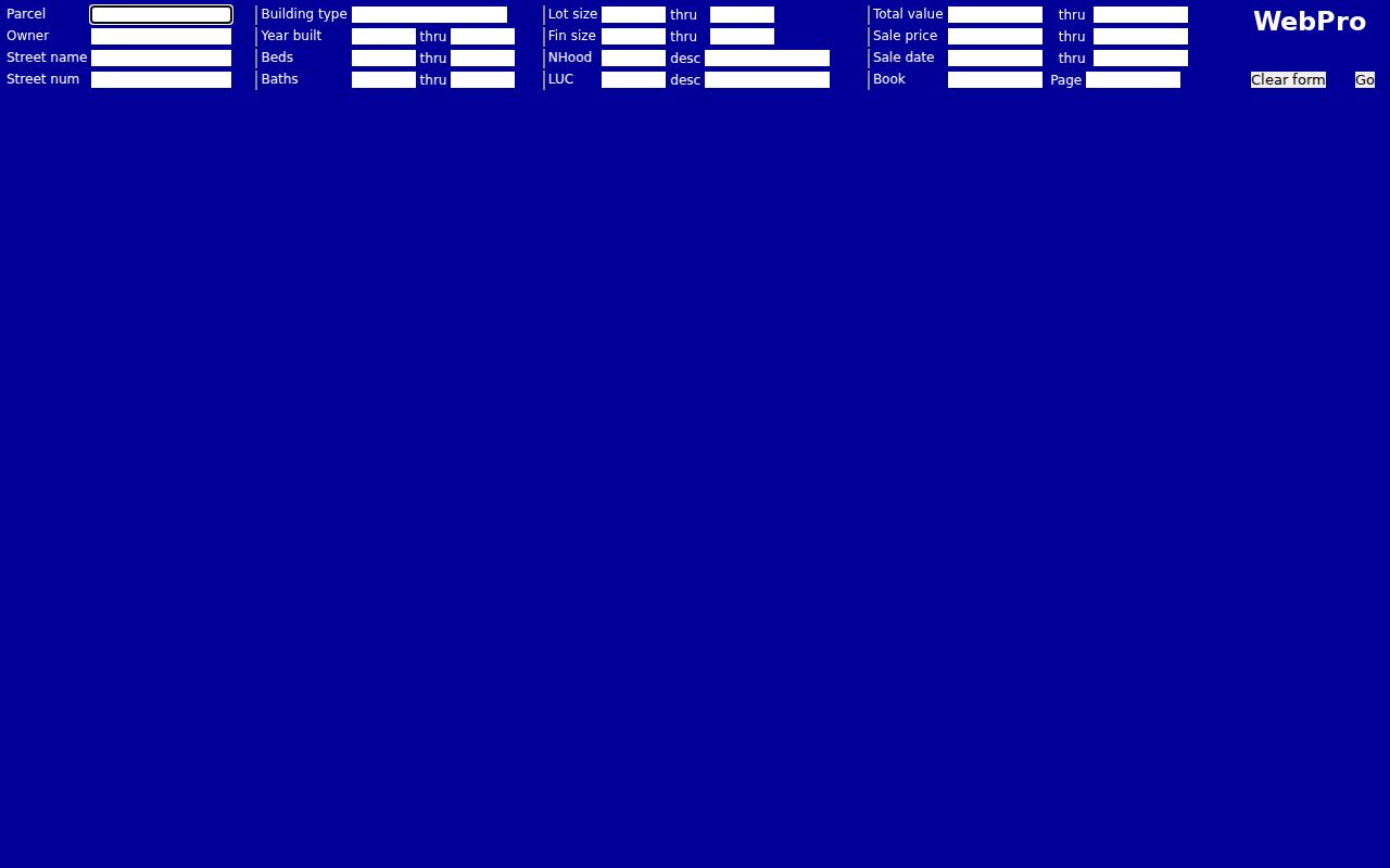
After an assessor result, the next fact to verify is the recorded transfer or plan reference, not a guess about the names on nearby cards. The portal is a valuable block crosswalk because it supports both street and parcel paths, while the Registry gives the recorded land evidence.
Marshfield Neighbors in Dated Civic Files
Massachusetts separates the public local voter list from the statewide central registry. The state’s status lookup uses a name, date of birth, and residential ZIP to return registration and polling information. It is not a public block-search tool. A local public-file request goes to the Marshfield Town Clerk and should specify a year, a narrow geography if supported, desired public fields, format, and whether a redacted sample is acceptable. A clearly scoped request can also be sent through Marshfield FOIA Direct.
The Secretary of the Commonwealth identifies public local-file fields that can include name, address, party, date of birth, active or inactive status, voter ID number, and some history fields. Phone, email, veteran status, permanent absentee information, confidential-voter information, and information about minors are not public. The Town Clerk’s resident street-list links for 2016–2021 are a separate local compilation; their field definitions were not captured and should be inspected before using them as a historical household source.
Note: A dated municipal response is more reliable for a historical question than a current status screen, but confidential registration must never be reconstructed from other records.
Marshfield Neighborhood Groups Provide Context
Local organizations can explain a place name or a public event, but they do not supply an all-purpose neighbor list. The research identified four source-backed organizations with different contexts. Their public material can help distinguish a shoreline place, campground community, or harbor institution from a parcel or household record. No comprehensive current membership directory was located in official sources, so board and event information should not be republished as a block roster.
| Organization | Useful public context | Limit |
|---|---|---|
| Original Brant Rock Village Association | Brant Rock public events, meetings, venues, and local place vocabulary. | Public board or event material is not a membership roll. |
| Ocean Bluff Preservation Association | Shoreline-preservation purpose and Ocean Bluff context. | Does not establish who lives in a neighborhood. |
| Blackman’s Point Homeowners’ Association | Resident-association context for the Blackman’s Point RV and Campground in Brant Rock. | Not a general Brant Rock directory. |
| Green Harbor Yacht Club | Organizational and harbor-place context. | Harbor affiliation is not a residence record. |
Ventress Memorial Library and the Marshfield Historical Society add a different local layer. They can help identify an older road name, town report, family paper, photograph, historic house, or local publication. Ask a repository for the precise source type, year, and access limits. A catalog name match is a research lead, not proof that a person belonged to an organization or occupied a nearby parcel.
Marshfield Neighbors Near Coastal Villages
Marshfield’s coastal places make block research especially date-sensitive. The town plan identifies Rexhame, Fieldston, Ocean Bluff, Brant Rock, and Green Harbor as distinct coastal or village contexts. Historic maps can show street and building changes, while planning labels, postal labels, and deed descriptions can use different boundaries. Keep the actual parcel, the source date, and the label used by that source rather than treating a village name as a fixed legal boundary.
Coastal records can add context without answering a household question. Harbormaster material may identify moorings, vessels, waitlists, pier plans, or shoreline programs. Such entries may involve a seasonal user, vessel owner, trust, or business. They should be labeled by their record type and date, never converted into a statement that someone is a current neighbor at a nearby address.
A useful historic cross-check is a 1916 or 1954 Sanborn sheet paired with an exact parcel and a recorded plan. The map can show a footprint or older street setting. The assessor and Registry then supply the administrative and land-record layers. This keeps the coastal history readable without collapsing map, deed, and person records into one claim.
Marshfield Neighbors Require Plan Verification
Plymouth TitleView offers recorded-land name, property, document, book, plan, and historical index searches. For a block question, use it after the map and assessor stages to inspect the recorded lot, plan reference, deed party roles, document type, recording date, and image availability. The Registry’s plan coverage runs from 1890 to the present, while books start in 1686 and the older online workflow has unindexed-book limits.
Search and viewing are free; printing is handled differently from a recorded or certified copy. Record the exact query, town filter, visible result, and source date. A current title question requires the recorded land evidence, while the assessment card remains a dated municipal lead. This distinction matters where a subdivision, consolidation, or easement changes the apparent relationship between lots.
TitleView’s Plymouth landing page shows the official search paths and its access notice.
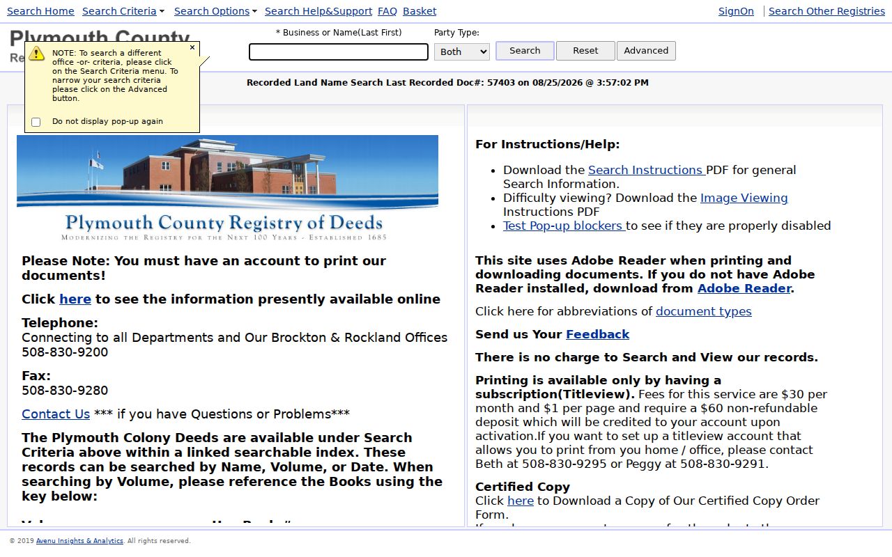
The strongest conclusion about adjacent land is modest: the plan and deed describe a relationship at their recorded date. They do not establish who was present on the block before or after that date.
Marshfield Neighbor Lookup Limits
Official parcel and civic files are better research sources than a commercial neighbor-search category because they show the custodian, field type, and date. They also have clear limits. Assessor cards can identify tax and mailing fields, not all residents. Voter records have public and withheld fields. Court, vital, medical, juvenile, and address-confidentiality material may be restricted. A current or historical public source must not be used to bridge a protected gap.
Massachusetts offers an Address Confidentiality Program for qualifying people facing certain safety risks, and confidential voter registration can suppress ordinary name and address access. When a source redacts or withholds an address, leave it that way. Do not combine a parcel card, directory, or map to reconstruct the protected information. Requests for segregable public portions should go to the appropriate custodian through the public-records process.